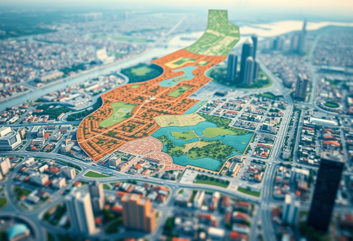
How Can Cartographic Precision Mitigate Land Mapping Challenges In Urban Planning?

Cartography plays a vital role in overcoming the complexities of land mapping within urban planning. By leveraging precise cartographic techniques, you can enhance your understanding of spatial relationships and land use patterns, leading to more informed decision-making. This post will explore how incorporating accurate mapping technologies can improve your urban planning processes, helping to address … Read more

How Do Geospatial Technologies Revolutionize The Quintessence Of Land Mapping?

There’s no denying that geospatial technologies have transformed how you map and understand land. By integrating advanced tools like GIS, GPS, and remote sensing, you can now visualize, analyze, and interpret spatial data in unprecedented ways. This post will guide you through the innovative ways these technologies enhance your capabilities in land mapping, making your … Read more

What Role Does Topographical Complexity Play In Effective Land Planning Strategies?

Many land planners and developers overlooking the significance of topographical complexity may find their projects challenging and inefficient. Understanding the terrain’s variations is vital in optimizing land use, managing resources effectively, and preserving the environment. By considering factors such as slope gradients, elevation changes, and natural features, you can make informed decisions that align with … Read more

Can Meticulous Zoning Practices Alleviate The Paradoxes Of Land Mapping?

Over time, land mapping has revealed intricate paradoxes that complicate urban development and resource management. You may wonder how meticulous zoning practices can address these challenges. By implementing detailed zoning regulations, you can enhance land use efficiency, reduce conflicts among stakeholders, and create harmonized communities. This blog post will explore how thoughtful zoning can clear … Read more

How Does The Confluence Of Environmental Factors Challenge Traditional Land Mapping Techniques?

Understanding Traditional Land Mapping Techniques The traditional land mapping techniques have evolved significantly, beginning with rudimentary methods such as drawings on parchment and hand-drawn maps, to more precise, technology-driven approaches embraced today. As societies progressed, so did the complexity of mapping tools, integrating aspects of geography, culture, and politics into various mapping systems. (A key … Read more