Many map enthusiasts and professionals find that understanding sections and quarter sections can significantly streamline the process of digitizing hard copy maps. These divisions, rooted in the Public Land Survey System, break vast landscapes into manageable parcels, allowing you to easily identify and convert geographic data. By leveraging these standardized units, you can enhance accuracy and efficiency while ensuring consistency across your digital mapping projects.
The Historical Significance of Sections and Quarter Sections
Understanding sections and quarter sections offers valuable insight into how land was systematically divided for agricultural and administrative purposes, shaping land ownership and usage in the United States. Instituted by the Land Ordinance of 1785, this grid system simplified land sales and organization, allowing for a more structured approach to settlement, agriculture, and infrastructure development. This historical framework laid the foundation for modern mapping and land management practices, which continue to influence urban planning and land use today.
The Origins of Land Division Practices
Land division practices date back to ancient civilizations where territorial boundaries were established for agriculture and governance. In the U.S., the Land Ordinance of 1785 introduced a standardized system of division, using a rectangular grid format that provided a clear method for identifying and selling land parcels. This method not only streamlined transactions but also ensured equitable access to land for new settlers.
Evolution of Mapping Techniques Over Time
Mapping techniques have undergone significant transformations since their inception, evolving from simple hand-drawn maps to complex digital representations. Early cartographers relied on rudimentary tools and personal observations, while modern methods utilize satellite imagery and GIS technology, enabling precise mapping of sections and quarter sections. This evolution has enhanced accuracy in land surveys, facilitating better urban planning and resource management.
Technological advancements have revolutionized how maps are created and utilized. The invention of aerial photography in the early 20th century provided a new perspective on land layouts, while the advent of Geographic Information Systems (GIS) allowed for dynamic, data-driven mapping. Today, satellite technology enables real-time updates of land use patterns and environmental changes. As a result, sections and quarter sections can be visualized with unprecedented detail, aiding not only in land development but also in environmental conservation and disaster planning. This historical progression illustrates the ongoing impact of mapping techniques on our understanding and management of land resources.
The Benefits of Digitizing Sections and Quarter Sections
Digitizing sections and quarter sections enhances your efficiency in managing geographic data. By transforming physical maps into digital formats, you gain access to precise information that is easily updated and shared. This allows for enhanced analysis and supports better decision-making in land use, urban planning, and resource management, providing you with a comprehensive view of property boundaries and ownership.
Improving Accuracy in Cartography
Accuracy is paramount in cartography, and digitizing sections and quarter sections significantly enhances it. By converting hard copy maps into digital formats, you reduce human error associated with manual data entry and ensure precise coordinates and measurements. This accuracy helps you create reliable maps that convey the true representation of the landscape and facilitates effective communication among stakeholders.
Streamlining Data Management Processes
Streamlining data management processes becomes effortless when you digitize sections and quarter sections. Digital platforms allow for organized storage, easy retrieval, and straightforward updates in real-time. Geographic Information Systems (GIS) enable you to visualize, analyze, and interpret the data effectively, making collaboration with other professionals more seamless and efficient. You can quickly assess land use changes, monitor planning developments, and maintain current property records, all while optimizing your workflow.
Enhancing Geographic Information Systems (GIS) with Land Division
Integrating sections and quarter sections into GIS enhances your map analysis capabilities, allowing you to visualize land divisions with incredible precision. By using the Public Land Survey System (PLSS), you gain access to an organized framework that supports better management of resources and land-use planning. This structured approach not only aids in data retrieval but also ensures that you can layer various data types effectively, leading to a more comprehensive understanding of geographic spaces.
Integrating Sections in GIS Applications
Incorporating sections into GIS applications allows you to overlay land use, zoning, and environmental data directly onto a standardized grid. Sections provide uniformity in mapping, which simplifies tasks such as property assessment and land-use planning. You can easily manipulate this spatial data, making it more intuitive to analyze land properties and their associated regulations.
Spatial Analysis and Improved Decision-Making
Utilizing sections for spatial analysis refines your decision-making processes by providing critical insights into land attributes and patterns. GIS systems can analyze data across sections, revealing trends regarding population density, resource distribution, or environmental impacts. This geospatial intelligence enables you to make data-driven decisions, whether for urban planning, agricultural initiatives, or environmental conservation.
When conducting spatial analysis, consider how sections represent land consistently, allowing you to aggregate various datasets for deeper insights. For instance, analyzing water resources across sections can highlight areas of scarcity or pollution. You may track land development trends by evaluating sections over multiple years, identifying shifts in land use. This level of detail supports proactive planning, allowing you to anticipate challenges and seize opportunities for better land management and sustainable practices.
Practical Steps for Effective Digitization
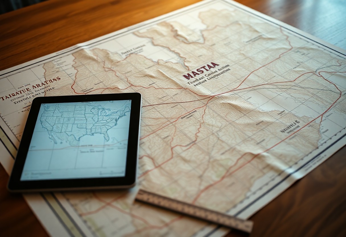
Effective digitization of hard copy maps involves a systematic approach that enhances accuracy and eases future modifications. Begin by thoroughly assessing the quality and size of your maps, ensuring they are suitable for digitization. Scanning at a high resolution is vital, as it preserves the intricate details necessary for precise mapping. Once scanned, use coordinate systems and reference points to align your digital maps, facilitating integration with existing GIS systems. Monitor these steps closely to ensure you capture every detail accurately, setting a solid foundation for digital work.
Tools and Software for Mapping Conversion
Selecting the right tools and software significantly streamlines the mapping conversion process. Software options like ArcGIS, QGIS, and AutoCAD are highly regarded for their robust features tailored to map editing and data analysis. These platforms allow you to import scanned maps and use georeferencing functions, ensuring your digital copies retain their real-world context. Investing in these tools can enhance your workflow and elevate the quality of your digital archives.
Best Practices for Maintaining Data Integrity
Maintaining data integrity throughout the digitization process requires meticulous attention to detail and regular checks. Implement version control to track changes and prevent data loss. Create backups at various stages of the digitization process, safeguarding against potential errors. It’s also beneficial to establish a standardized naming convention for files, ensuring you can easily locate specific maps and versions later. Regular audits of your data can identify inconsistencies early, enabling you to correct issues before they escalate.
Adopting version control systems like Git can enhance data management significantly. By tracking changes over time, you not only maintain a clear history of modifications but also allow for easy rollbacks if an error occurs. Backing up your data across multiple devices and cloud solutions adds an extra layer of security, mitigating the risk of loss due to hardware failures. Establishing a naming standard for map files, incorporating details like date and project name, facilitates efficient organization and retrieval. Regular data audits further ensure that any discrepancies or errors can be addressed swiftly, fostering a dependable mapping resource for future use.
Future Trends: Beyond Traditional Mapping
Advancements in technology are continually reshaping the landscape of mapping, with innovative tools and methodologies emerging. The digitization of maps will increasingly incorporate dynamic data sources, enabling real-time updates and enhanced user interaction. As satellite imagery and drone technology evolve, you can expect mapping to become more detailed and accessible, offering deeper insights into geographic and spatial relationships. Collaborative platforms will also facilitate sharing and editing maps, making it easier for communities and organizations to contribute to mapping efforts.
The Role of AI and Machine Learning
AI and machine learning are transforming how you analyze and interpret geographic data. By automating the extraction of features from raw map images, these technologies enhance accuracy and efficiency in map digitization. Predictive analytics can also identify patterns and trends within geographic data, allowing you to make informed decisions and anticipate future changes in land use and development. As these tools become more sophisticated, they can significantly improve your mapping capabilities.
Potential Impacts on Urban Planning and Development
The integration of advanced mapping technologies profoundly affects urban planning and development strategies. As you utilize real-time data, urban planners can better address issues like traffic congestion, resource allocation, and environmental impact. Enhanced map visualizations enable stakeholders to engage with data more meaningfully, fostering collaborative decision-making. Moreover, understanding spatial relationships through sophisticated mapping tools promotes sustainable development and efficient land use.
In urban planning, these mapping advancements help identify areas requiring infrastructure improvements or green spaces, guiding investment decisions. For example, cities like San Francisco leverage real-time data for their urban growth management, making adjustments based on population trends and economic shifts. This proactive approach benefits residents by optimizing public services and enhancing livability, ultimately resulting in vibrant, resilient communities. Furthermore, as you incorporate AI-driven insights, your ability to forecast urban needs becomes significantly more precise, enabling better preparation for future challenges.
Summing up
On the whole, utilizing sections and quarter sections streamlines the process of digitizing hard copy maps by providing a systematic framework for organizing geographic data. This structured division allows you to pinpoint specific areas with precision, enhancing both accuracy and efficiency in your mapping efforts. By breaking down larger land parcels into manageable segments, you simplify coordination, reduce errors, and improve the overall quality of your digital representation. Ultimately, mastering this method empowers you to create clear and effective maps with greater ease.