It’s vital to understand zoning regulations if you want to optimize your land maps effectively. These regulations can significantly impact your property development plans and land use. By following the six steps outlined in this guide, you’ll gain clarity on how to navigate these complexities, ensuring that your maps not only comply with local laws but also serve your needs. Let’s examine the steps that will help you streamline the process and maximize your land’s potential.
Identifying Zoning Regulations
A comprehensive understanding of zoning regulations is necessary for optimizing your land maps. They dictate how you can use your property and influence your future planning decisions. Knowledge of local zoning laws will enable you to navigate potential hurdles and maximize the utility of your land. The first step in this process involves thorough research into both local ordinances and zoning maps. Taking the time to study these resources can save you from costly mistakes and ensure your projects align with local guidelines.
Researching Local Ordinances
Researching local ordinances is a vital part of identifying zoning regulations. Start by visiting your local government’s website or planning office. Look for documents related to zoning codes, land use policies, or development regulations. These ordinances will give you insight into what is permitted on your property and any restrictions that may apply. It is important to note that these regulations can vary widely between jurisdictions; therefore, ensure you focus specifically on your area.
Additionally, you may find it beneficial to attend community meetings or consult directly with local officials. This personal engagement often provides clarity on complex regulations and offers the opportunity to ask questions tailored to your specific needs. Engaging with local stakeholders can also give you a sense of future developments or changes in policies that may affect your land.
Reviewing Zoning Maps
With the completion of your research on local ordinances, the next step is to review zoning maps specific to your area. These maps visually represent the zoning classifications and restrictions applicable to different parcels of land. By examining them carefully, you can determine the zoning designation assigned to your property and understand how it impacts your development plans.
For instance, zoning maps illustrate whether your land is designated for residential, commercial, industrial, or agricultural use. They often reveal the boundaries of different zones, helping you identify surrounding properties and potential influences on your land. Understanding these classifications enables you to plan your use of the property more effectively, ensuring compliance with local regulations and enhancing the overall functionality of your land. Always remember that adhering to zoning requirements will preserve the integrity of your development efforts.
Assessing Land Use
The process of assessing land use is crucial for ensuring compliance with zoning regulations. Understanding how your land can be utilized helps you to make informed decisions about its development and optimization. This chapter focuses on key components of land use assessment: determining property boundaries, evaluating environmental factors, and considering neighboring land uses.
Determining Property Boundaries
Assessing property boundaries is the first step in understanding your land’s use potential. You need to clearly define where your land begins and ends, as this will dictate what you can legally do with it. Start by locating your property’s title deed, which should contain a detailed description of the boundaries.
You may also want to consider hiring a licensed surveyor to perform a formal land survey. This ensures accuracy and provides a professional interpretation of your property lines. An accurate understanding of your boundaries can help you avoid disputes with neighbors and comply with local zoning laws.
Evaluating Environmental Factors
Property assessments also require you to evaluate the environmental factors affecting your land. This involves analyzing natural features such as water bodies, wetlands, vegetation, and wildlife habitats. Understanding these aspects is imperative since they may influence zoning regulations and land use permissions.
- Soil condition: Is it suitable for construction or agriculture?
- Water drainage: Are there any flood risks or drainage issues?
- Noise pollution: Is your land impacted by nearby industrial activities?
- Wildlife: Are there protected species or habitats on or near your land?
Thou should thoroughly document these environmental factors to inform your land use planning. Addressing these elements upfront can save you from costly modifications down the line.
Considering Neighboring Land Uses
Considering neighboring land uses is another vital step in the assessment process. Understanding how adjacent properties are utilized can impact your project’s feasibility and compliance with zoning standards. Investigate the types of businesses or residential areas nearby, as these may affect your land’s value and development potential.
Looking at neighboring land uses can also reveal opportunities or challenges. For instance, if your land is near commercial areas, it may be advantageous for retail developments. However, residential zones could impose restrictions that affect your plans. Gather this information so you can strategize effectively.
Determining the uses of neighboring lands can help you anticipate market demands and potential conflicts. The proximity of different zoning types can drastically alter the requirements and opportunities present for your land.
- Compatibility: Do your intentions align with nearby land uses?
- Traffic patterns: How will they affect access to your property?
- Development trends: What are the future plans for the surrounding area?
- Community considerations: Are there local needs your project could meet?
Thou will see that understanding these dynamics is imperative for making calculated decisions and optimizing your land effectively.
Defining Project Objectives
All successful projects begin with a clear understanding of objectives. When navigating zoning regulations, defining what you want to achieve is crucial. This not only guides your decisions but also serves as a benchmark for evaluating your progress. Take time to articulate your vision. It’s helpful to write down your primary goals. Consider factors such as the type of development, the community’s needs, and the potential challenges you may face. With well-defined goals in place, you can create a roadmap to navigate the complexities of land use and zoning.
Establishing Clear Goals
Objectives should be specific, measurable, achievable, relevant, and time-bound (SMART). By ensuring that your project goals follow this framework, you increase the likelihood of success. For instance, instead of saying “I want to develop a community park,” specify “I want to design and build a community park with a playground and picnic area by the end of next year.” This clarity allows you to allocate resources effectively and stay focused on outcomes that matter.
Identifying Key Stakeholders
Identifying the key stakeholders in your project is imperative. These individuals or groups will influence—or be influenced by—your decisions. Stakeholders can include local government officials, residents, businesses, and various community organizations. Understanding their interests and expectations can help you shape your project in a way that garners support and minimizes opposition. Take the time to map out who the stakeholders are and how they fit into the bigger picture of your project.
Another step in identifying stakeholders involves evaluating their influence and relevance to your project. You might find some community members are passionate about environmental conservation while others are focused on economic growth. By understanding these varying priorities, you can create a project that seeks to meet diverse needs. Engaging stakeholders early can pave the way for collaboration, leading to a project that is more likely to see success in navigating zoning regulations.
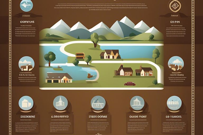
Mapping Land Use Zones
Once again, submerging into the complexities of zoning regulations can feel overwhelming. Yet, understanding how to create a clear and cohesive land use map is necessary in optimizing your land. The first step is recognizing that your map must detail the different zoning areas based on their intended purpose. This visual representation will serve as the backbone for all your planning efforts, ensuring you remain compliant with the local government’s zoning ordinances.
Creating a Base Map
Zones are usually categorized by their specific functions such as residential, commercial, or industrial usage. To initiate the mapping process, you will need to create a base map that includes all existing features on your land, including streets, buildings, and natural boundaries. This foundational map provides a crucial framework that enables you to accurately denote the various zones and their extents.
Identifying Zoning Districts
Base maps should be layered with additional data about zoning districts. Each zoning district has characteristic regulations that dictate the type of development allowed. To identify these zones, you can refer to local zoning maps and ordinances. This information will help you categorize the land within your base map accurately.
This process requires careful attention to regulations, as zoning laws can change. Ensure that you stay up to date with municipal planning departments or consult a land-use professional to verify the latest zoning updates. This diligence ensures your work reflects current standards and regulations.
Marking Land Use Restrictions
To further refine your land use map, you need to mark land use restrictions. These restrictions often come from various sources, including local regulations, environmental guidelines, or private covenants. Each of these can significantly affect your property’s development potential and overall use. Make pinpoint markings on your map to denote these specifics clearly.
Marking these restrictions accurately is crucial for strategic planning. Failing to account for them might lead to costly changes later in the development process. Use specific symbols or color codes to create an intuitive visual guide for anyone reviewing your land use map.
Optimizing Land Use
Not every piece of land is utilized to its fullest potential. When you look at your property, you might notice areas that are underperforming or neglected. This underutilization can stem from a variety of factors, including outdated zoning laws or unanticipated changes in community needs. By assessing your land thoroughly, you can pinpoint these inefficiencies and begin to create a plan that maximizes its potential.
Identifying Inefficiencies
Identifying inefficiencies in your land use starts with a careful examination of how each area is currently being utilized. Take into account the various elements on your property, such as structures, green spaces, and pathways. Are there dead zones with little to no activity? Do certain sections serve outdated purposes? Understanding the current landscape will help you see where improvements can be made, allowing you to optimize access and functionality.
In your assessment, consider engaging with community members or seeking feedback from local businesses. Often, those who interact with the space daily have valuable insights into what works and what doesn’t. Use this data to inform your decisions, ensuring you’re not just strategizing in a vacuum.
Exploring Alternative Land Use Options
For a more effective utilization of your land, exploring alternative land use options is vital. The realm of land use is constantly evolving, shaped by economic trends, demographic shifts, and environmental factors. What may have once been deemed an optimal use of space could now seem outdated or even counterproductive. Assessing the viability of alternative uses can unlock new opportunities.
Alternative uses may range from community gardens that promote local food production to mixed-use developments that combine residential, commercial, and recreational spaces. Flexibility in your planning will allow you to adapt to changing needs and trends, ensuring the land serves its community well into the future.
Developing a Land Use Strategy
An effective land use strategy is crucial for optimizing the value and functionality of your property. Start by clearly defining your goals. Do you want to increase green space, improve traffic patterns, or boost property values? Establishing a roadmap based on these objectives will help guide all your future decisions.
Land use planning is not a one-time endeavor; it requires continuous evaluation and adjustment. As you implement your strategy, remain open to feedback from stakeholders and be ready to modify your plans as needed. A successful strategy anticipates changes and prepares for them, setting you up for long-term success. The result will be a vibrant, well-functioning space that meets the current needs of your community and adapts seamlessly to future demands.
Overcoming Zoning Challenges
Many landowners face zoning challenges that can complicate their development plans. Understanding these obstacles is crucial for ensuring your project remains feasible and compliant. It’s vital to recognize that zoning regulations can vary widely from one jurisdiction to another, often creating conflicts that you will need to address proactively. Successfully overcoming these challenges will require patience, diligence, and a well-planned strategy.
Addressing Conflicting Regulations
With the complexity of zoning laws, it’s not uncommon to encounter conflicting regulations that can hinder your development progress. Identifying these conflicts early on is critical. For example, you might find that certain aspects of your project align with local plans, while others do not. This discrepancy can create a maze of compliance issues that you must navigate carefully to avoid delays or penalties.
Working closely with local planners can help clarify the discrepancies you face. They can provide insight into which regulations take precedence and how to amend your plans accordingly. Additionally, you might consider seeking legal counsel specializing in zoning regulations to guide you through the intricacies of conflicting laws.
Navigating Appeals Processes
The appeals process can be daunting, especially if your project has been denied due to zoning issues. Understanding the procedure will empower you to take the necessary steps to present your case. Start by getting familiar with the local appeals board and their specific requirements. You need to know what documentation and evidence will support your claims and how to present them effectively.
Also, the process can take time. Be prepared for potential delays and stay informed about your application’s status. Engaging with fellow stakeholders can also be beneficial. Their support may strengthen your case and lend credibility to your appeal. Review your application critically to ensure all details are accurate and compelling.
Navigating the appeals process requires diligence and preparation. You may need to gather additional research, testimonies from community members, or findings from previous similar decisions. Every piece of evidence can bolster your claim and illustrate why your project aligns with community values. Remember to communicate regularly with the appeals board to maintain transparency and keep your appeal on track.
Building Relationships with Local Authorities
Local authorities play a vital role in your zoning journey. Establishing solid working relationships with these entities can significantly smooth the process. Approach key officials with respect and transparency. Attend community meetings and engage in conversations that highlight your commitment to understanding local concerns. An open line of communication can provide valuable insights and foster goodwill, which can be beneficial in a regulatory environment.
Active engagement with local authorities can lead to collaborative solutions. When you demonstrate a willingness to work together on community goals, you may find them more open to your development proposals. They will see you as a partner rather than just another applicant, making it easier to navigate any zoning hurdles in your path.
To foster these relationships effectively, consider hosting informal gatherings or meetings where you discuss your project in a casual environment. This not only helps authorities to understand your perspective but also allows you to receive feedback early in the process, giving you the chance to adjust your plans to meet community expectations before submitting formal applications.
To wrap up
With these considerations in mind, navigating zoning regulations can be a more manageable process for you. Following the six steps outlined will help you optimize your land maps and ensure compliance with local laws. Understanding the specific requirements of your area allows you to plan effectively and avoid potential legal hurdles that could hinder your projects. Each step gives you clarity and confidence as you move forward in your planning initiatives.
Keep in mind, efficient land management is not just about compliance; it is about maximizing the potential of your property. By actively engaging with zoning regulations and taking the time to refine your maps, you position yourself to make informed decisions that can lead to greater success in your endeavors. Use this guide as a roadmap to steer you through the complexities of zoning, so you can focus on achieving your land development goals.