Many land planners and developers overlooking the significance of topographical complexity may find their projects challenging and inefficient. Understanding the terrain’s variations is vital in optimizing land use, managing resources effectively, and preserving the environment. By considering factors such as slope gradients, elevation changes, and natural features, you can make informed decisions that align with your development goals. This blog post explores how topographical complexity influences effective land planning strategies and offers insights to enhance your planning efforts for sustainable and thriving communities.
Understanding Topographical Complexity
To effectively engage in land planning, it is crucial to comprehend the intricacies of topographical complexity. It encompasses the variation in landforms that can significantly impact how land is used, developed, and accessed. By recognizing features such as elevation, slope, and contour, you can make informed decisions that align land use with geographic realities (Strategic land use leverages topographical analysis).
Definition and Characteristics
Definition: Topographical complexity refers to the diverse range of physical features presented by a landscape, including its elevation, slope, and contours, which play pivotal roles in land use planning. These characteristics can dictate drainage patterns, vegetation types, and accessibility, influencing your decisions on infrastructure development and environmental conservation (Understanding these elements shapes effective project outcomes).
- Elevation contributes to climate variations and biodiversity.
- Slope affects water runoff and soil erosion potential.
- Contours define land surface interactions and viewsheds.
- Topographical orientation impacts solar access and microclimates.
- Any topographical analysis enhances project feasibility and sustainability.
| Characteristic | Implication |
|---|---|
| Elevation | Affects climate and vegetation |
| Slope | Influences drainage and erosion |
| Contours | Determines water flow and accessibility |
| Aspect | Impacts solar exposure and microclimates |
| Land cover | Influences biodiversity and land use |
Types of Topographical Features
On the spectrum of topographical features, you find mountains, valleys, hills, and plains, each presenting unique challenges and opportunities for land planning. Mountains often require adaptive design strategies for elevation differences, while valleys can be prime areas for agriculture due to their rich soils. Hills might demand innovative infrastructure solutions to manage slopes, and plains can facilitate extensive development (Design plans must consider the trade-offs posed by these landforms).
- Mountains require careful management of access and conservation efforts.
- Valleys are often ideal for agriculture and urban development.
- Hills can challenge transportation but offer scenic views.
- Plains provide expansive, flat land for various uses.
- Any development in these areas must balance natural features with human needs.
| Topographical Feature | Planning Implication |
|---|---|
| Mountains | Access and conservation focus |
| Valleys | High agricultural potential |
| Hills | Infrastructure design challenges |
| Plains | Flexibility for large-scale development |
| Plateaus | Unique ecosystems and settlement patterns |
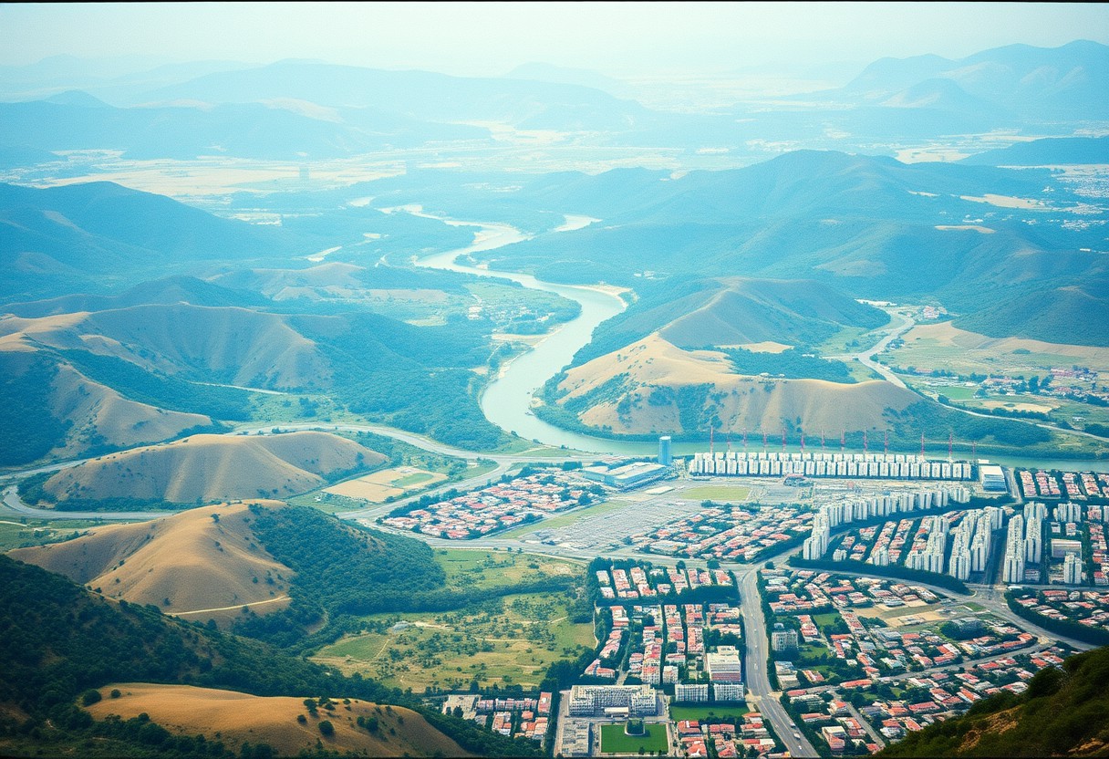
The Impact of Topography on Land Use
Now you can understand how topography significantly shapes land use decisions. Varied landforms, from steep mountains to gentle valleys, dictate how areas can be utilized. Steeper terrains often limit conventional farming practices and urban development, while flatter regions may enhance accessibility and resource management. As a result, incorporating topographical analysis into planning can lead to more sustainable and effective land use strategies.
Agriculture and Natural Resources
Topography plays a vital role in determining agricultural practices, resource availability, and conservation strategies. Variations in elevation, soil types, and drainage patterns affect crop choices and irrigation methods. In areas with complex topography, you may need to adopt contour farming or terracing techniques to minimize soil erosion and optimize water usage, ultimately contributing to sustainable resource management.
Urban Development and Infrastructure
Agriculture becomes more challenging when planning urban developments, especially on uneven land. Your proposals for infrastructure must consider factors such as slope stability, drainage systems, and accessibility. Uneven land can lead to higher construction costs and complicate transportation routes, impacting the overall efficiency of urban areas. (An important decision revolves around how to integrate green spaces in challenging terrains.)
Another significant challenge in urban development is balancing the need for infrastructure with the preservation of existing natural features. Incorporating elements like green roofs or retaining walls may mitigate some difficulties posed by slope, helping to create functional spaces. You must prioritize innovative design approaches that harmonize with topographical characteristics to enhance community resilience. (Strategically planning these layouts can dramatically impact the livability of urban areas.)
Environmental Considerations
Assuming you take into account the intricate relationship between topographical features and environmental health, effective land planning strategies become vital. Understanding how hills, valleys, and waterways affect the surrounding ecosystems can significantly inform your decisions. By actively considering these elements, you can promote sustainability, ensuring that your land use respects natural processes while minimizing adverse impacts on the environment. (A thoughtful approach can mitigate potential ecological damage.)
Ecosystems and Habitat Preservation
At the core of land planning, your recognition of the relationship between topographical features and ecosystem diversity is vital for habitat preservation. The complexity of the landscape supports various habitats that host diverse species, making it imperative for you to incorporate these considerations into your strategies. Planning that prioritizes ecosystem integrity can ensure that species thrive and maintain biodiversity. (Prioritizing habitats can guide zoning regulations effectively.)
Natural Disasters and Risk Management
About the connection between topographical complexity and vulnerability to natural disasters, recognizing how features like mountains and valleys influence disaster risk is vital for your planning process. Areas with intricate landscapes can experience varied exposures to natural threats, such as flooding or landslides. By integrating risk management strategies, you can adapt land use to fit local terrain, minimizing potential hazards faced by communities.
Habitat fragmentation or degradation can increase risks associated with natural disasters. By understanding and addressing these vulnerabilities, your risk management strategies can incorporate natural solutions like preserving green spaces and enhancing drainage systems. Such approaches not only protect your community from disasters but also promote healthier ecosystems. Taking a comprehensive view of the topography allows you to develop effective contingency plans for unpredictable events.
Tools and Techniques for Analyzing Topography
After understanding the importance of topographical complexity, you can leverage various tools and techniques to analyze this data effectively. These tools can help you assess land characteristics, inform development strategies, and enhance overall planning outcomes. Utilizing the right technology will facilitate more informed decisions and lead to sustainable land use practices that harmonize with the natural landscape.
Geographic Information Systems (GIS)
Across the land planning field, Geographic Information Systems (GIS) play a vital role in analyzing topographical data. By mapping and visualizing terrain features, GIS enables you to assess environmental impacts, resource distributions, and infrastructure needs. Integrating this technology into your planning strategies enhances decision-making processes, allowing you to make data-driven choices that align with your land use goals.
3D Modeling and Simulation
Against traditional 2D maps, 3D modeling and simulation tools provide you with an immersive way to visualize topographical impacts on land use. These technologies enable you to manipulate virtual landscapes, assessing how different designs interact with natural features. By simulating various scenarios, you can identify potential challenges and opportunities, facilitating more informed and strategic land use decisions.
Information gleaned from 3D modeling can be instrumental in your planning process. By visualizing landforms in three dimensions, you gain insights into drainage patterns, slope stability, and suitability for development. This enhanced perspective allows you to foresee potential issues, optimize land use, and create designs that complement and respect the existing topography, ultimately enhancing both environmental sustainability and community outcomes.
Case Studies and Examples
For effective land planning, examining real-world applications reveals the impact of topographical complexity:
- 1. San Francisco, CA: Implemented green roofs, citing a 25% reduction in stormwater runoff.
- 2. Seattle, WA: Utilized natural slopes for terracing, improving urban heat management by 15%.
- 3. Asheville, NC: Integrated trail systems into mountainous areas, increasing community engagement by 30%.
- 4. Denver, CO: Adopted zoning changes to preserve ridgelines, contributing to a 20% increase in property values.
Successful Land Planning Strategies
Any effective land planning strategy showcases the seamless integration of topographical features. For instance, the city of Portland utilized its natural waterways to create urban parks, increasing biodiversity by 40% while enhancing recreational spaces for residents. Similarly, in New Orleans, planners adapted to the surrounding marshlands, successfully improving the flood defense system, which reduced water-related damage by 60%. These best practices exemplify how you can harness natural landscape features to uplift community planning.
Lessons Learned from Mismanagement
To prevent costly mistakes, examining land planning failures highlights the importance of respecting topographical complexities. The flooding incident in Baton Rouge, LA, where inadequate drainage overlooked local elevation changes, resulted in damages exceeding $100 million. Similarly, the neglect in considering the steep slopes of the Santa Monica Mountains led to a landslide, disrupting community infrastructure. You can learn from these experiences to foster more effective strategies in your own planning initiatives.
Mismanagement of land planning often stems from failing to acknowledge the subtleties presented by topographical complexity. When planners ignore features like natural slopes or waterways, you may find yourself facing significant repercussions, including environmental degradation and economic loss. Such oversights can result in damage claims that strain local budgets for years to come. By studying these missteps, you can leverage better practices in your land planning efforts, ensuring both ecological benefits and community resilience.
Final Words
Considering all points, understanding topographical complexity is imperative for your effective land planning strategies. By recognizing how the land’s natural features influence water drainage, soil stability, and vegetation growth, you can make more informed decisions that enhance sustainability and minimize environmental impact. This awareness allows you to maximize land utility while respecting ecological balances, ultimately paving the way for well-planned and resilient landscapes that serve your community’s needs.