With clear property boundary mapping in place, you can significantly reduce the risk of legal disputes related to land ownership. Understanding the precise limits of your property not only protects your rights but also helps you avoid costly conflicts with neighbors. By investing in accurate boundary surveys, you empower yourself with the information needed to address potential misunderstandings proactively. In this blog post, we’ll explore the benefits of property boundary mapping and how it can serve as a vital tool in preserving harmony and clarity in your property dealings.
Importance of Property Boundary Mapping
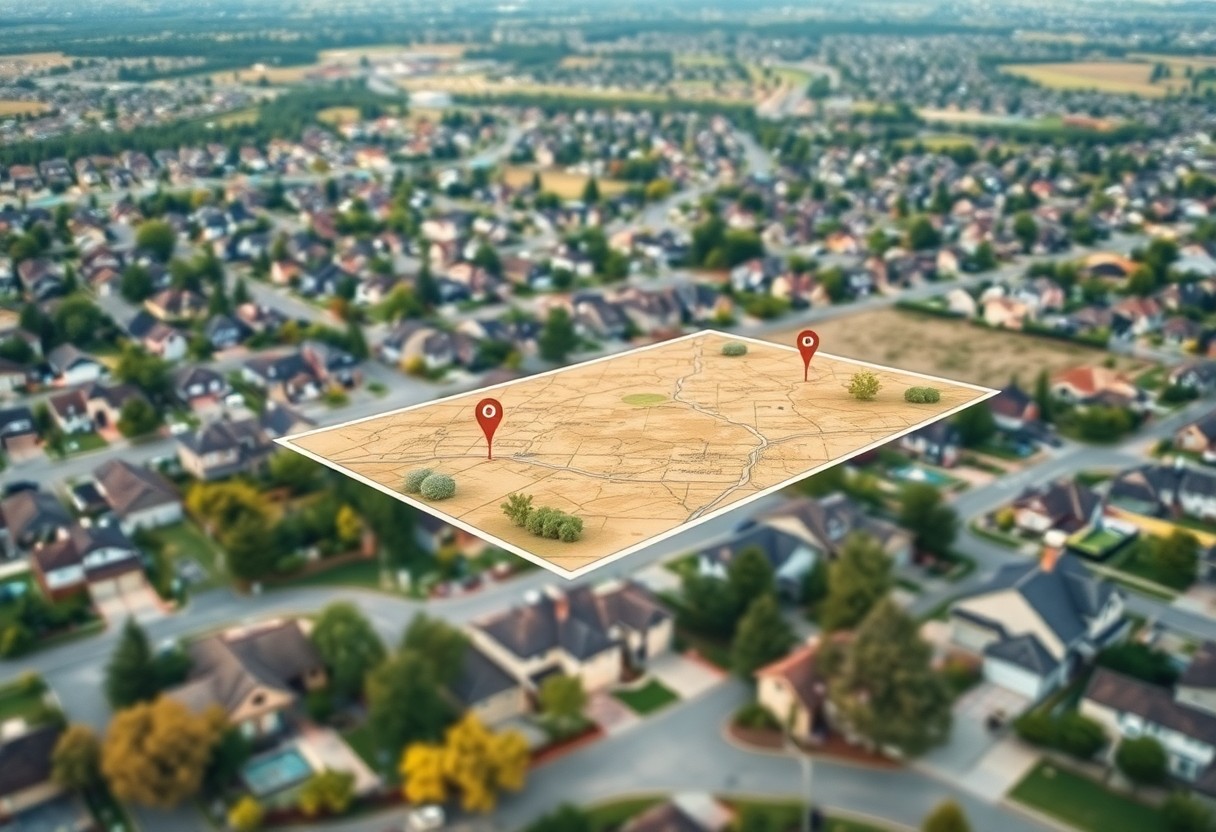
Before you invest in real estate or make improvements to your property, understanding the importance of property boundary mapping is vital. Accurate boundary maps provide a clear representation of your land, ensuring that you are fully aware of your rights and responsibilities. This not only aids in maintaining your property effectively but also serves as a preventative measure against potential legal disputes with neighbors over property lines, saving you time and money in the long run.
Understanding Property Lines
Among the fundamental aspects of property ownership is knowing where your property lines lie. Property lines define the exact boundaries of your land and indicate the areas you are legally entitled to use and develop. Familiarizing yourself with documents such as surveys and title deeds will equip you with the necessary information to avoid any misunderstandings or disputes with neighboring property owners.
Legal Implications of Boundary Disputes
Behind every boundary dispute often lies significant legal implications that can affect your ownership rights. When disputes arise, they may lead to costly litigation, loss of property access, or even the requirement to alter or remove structures that encroach upon your neighbor’s land.
This reality underscores the importance of having accurate property boundary mapping in place. Disputes can escalate quickly if boundaries are not clearly defined, leading to costly legal battles. By proactively obtaining a professional survey and understanding your property lines, you can avoid misunderstandings and ensure that you are protected in case issues arise. Engaging in proper mapping not only preserves your legal rights but fosters good relationships with your neighbors, creating a harmonious living environment.
Techniques for Accurate Boundary Mapping
The accuracy of property boundary mapping is vital to avoiding legal disputes. Various techniques are employed to ensure that boundaries are defined clearly and precisely. By understanding both traditional methods and modern technologies, you can better appreciate how to protect your property rights and maintain harmony with neighboring landowners.
Traditional Methods
Along with modern advancements, traditional methods of boundary mapping, such as land surveys and physical markers, have been instrumental in defining property lines. Surveyors typically rely on historical documents, existing landmarks, and property deeds to establish boundaries. Utilizing these methods, you can ensure that your property’s boundaries are accurately represented and respected.
Modern Technologies
Traditional techniques have now been augmented by modern technologies, such as Geographic Information Systems (GIS) and Global Positioning System (GPS) tools. These technologies provide enhanced precision in boundary mapping, allowing you to visualize and analyze your property lines more effectively. By incorporating these advanced tools into your mapping efforts, you can significantly reduce the chances of boundary-related disputes.
Even more, modern technologies can streamline the mapping process, offering quick and reliable results. GIS allows for the integration of various data layers, which can provide insights into zoning regulations, environmental constraints, and other factors influencing property lines. GPS tools, on the other hand, provide real-time data that can pinpoint specific locations with remarkable accuracy. By leveraging these innovative technologies, you empower yourself to create a thorough understanding of your property, ultimately preventing potential legal complications regarding boundaries.
Benefits of Property Boundary Mapping
Some of the key benefits of property boundary mapping include enhanced land use planning, improved dispute resolution, and increased property value. By accurately defining your property lines, you not only protect your rights but also ensure that potential buyers or investors have a clear understanding of what they are purchasing. This can lead to a smoother transaction process, enabling you to focus on leveraging your investment rather than defending it.
Prevention of Disputes
Beside helping you clearly define your property boundaries, accurate mapping can significantly reduce the likelihood of disputes with neighbors or even local authorities. By having precise documentation to back your claims, you can easily resolve misunderstandings regarding property lines before escalating to legal battles.
Clarity in Transactions
The accuracy of property boundary mapping offers clarity in transactions, making it easier for you to communicate your property’s specifications to potential buyers or lenders. When you have a well-documented boundary map, it reassures interested parties about their investment and minimizes the risk of future legal entanglements.
Benefits of having precise boundary documentation extend beyond just clarity; it can expedite the sale process and avoid complications that may arise due to unclear lines. When you provide potential buyers with a definitive property boundary map, it instills confidence in the purchase decision, allowing for a smoother transaction and fostering trust between all parties involved. This clarity can lead to quicker closings and fewer hiccups along the way, making your experience far more beneficial.
Case Studies on Boundary Disputes
For anyone interested in understanding the implications of boundary disputes, examining real-life case studies proves insightful. Here are some notable examples:
- In 2017, a family in California spent over $50,000 on legal fees due to an encroachment dispute involving a fence that was built 3 feet over the property line.
- A Massachusetts property owner lost a third of their lot in a lawsuit after failing to perform due diligence on existing surveys, resulting in a 2018 court ruling in favor of their neighbor.
- In 2020, a boundary disagreement in Texas escalated to litigation, costing both parties over $100,000 and resulting in a mediator’s intervention to settle.
Successful Resolutions
On numerous occasions, boundary disputes are resolved amicably through property boundary mapping. By securing a professionally conducted survey, you can clarify property lines, ensuring that both parties have a clear understanding of boundaries and responsibilities. This often leads to negotiated solutions that avoid litigation costs and preserve neighborly relations.
Legal Consequences of Ignoring Boundaries
About the legal ramifications, failing to address boundary issues can lead to significant liabilities. If you ignore your property lines, you risk encroaching on a neighbor’s land, which can result in costly lawsuits and potential court orders to remove structures or restore land to its original state.
Case law consistently demonstrates that property owners who neglect to verify their boundaries may face severe consequences. Not only can disputes escalate into legal battles, but losing a case can result in financial penalties and restrictions on your property use. Staying informed about your boundaries ultimately protects your investment and your peace of mind.
When to Seek Professional Help
Now, recognizing when to enlist a professional for property boundary mapping is imperative for maintaining peace of mind. If you are uncertain about your property lines, are facing potential disputes with neighbors, or are contemplating any property improvements, consulting a surveyor or land-use attorney could provide the clarity you need. Engaging a professional can help ensure that all boundary-related matters are addressed accurately, safeguarding your interests and avoiding possible legal complications.
Signs You Need a Surveyor
About determining whether you need a surveyor, look out for signs such as discrepancies in property lines, new construction projects, or unresolved disputes with neighbors. If you find that your property boundaries are unclear due to old deeds or changes in land use, it’s time to seek assistance. Recognizing these indicators early can prevent future misunderstandings and save you from potential legal challenges down the line.
Choosing the Right Professional
After you’ve identified the need for expert advice, selecting the right professional is imperative. Conduct thorough research to find a reputable surveyor or attorney who specializes in property law and boundary issues. Look for credentials, client reviews, and experience to ensure you are obtaining quality service.
Professional expertise is key in the property boundary mapping process. Seek individuals with a solid track record and specific knowledge of local regulations and legalities. It’s beneficial to schedule consultations to discuss your needs and gauge their understanding of your situation. Finding a qualified professional can pave the way for accurate boundary determinations and effective dispute resolutions, ultimately protecting your property rights.
Future Trends in Property Boundary Mapping
To ensure clarity and accuracy, property boundary mapping will continue to evolve, leveraging advanced technologies and increased regulatory efforts. Emerging trends indicate a greater integration of 3D mapping techniques, which provide a more detailed representation of property lines, enhancing your ability to understand and manage your land. Furthermore, you can expect the incorporation of geographic information systems (GIS) that streamline boundary determination processes, making it easier for you to prevent disputes and maintain harmonious relationships with neighboring property owners.
Technological Innovations
Around the world, the rise of drone technology and satellite imagery is transforming property boundary mapping. These tools allow for more accurate land surveys, enabling you to obtain clearer and more precise boundary definitions. By harnessing these innovations, you can better visualize your property lines, reducing the potential for disputes and simplifying the acquisition of necessary permits.
Evolving Legal Standards
Innovations in property boundary mapping are also shaping legal frameworks surrounding land ownership. As mapping technologies advance, so too do the legal standards that govern property disputes. This evolution ensures that your rights as a property owner are better protected, providing you with a clearer legal landscape in which to navigate boundary-related issues. The alignment of legal standards with modern mapping technologies empowers you to address disputes effectively and efficiently.
Also, as legal standards continue to evolve, it becomes increasingly important for you to stay informed about changes that may impact your property rights. Laws may adapt to better accommodate advancements in technology, further defining the responsibilities and rights of property owners. By understanding these shifts, you can proactively protect your interests and prevent potential legal conflicts regarding boundaries. Keeping abreast of these developments will enhance your ability to navigate property ownership with confidence.
Summing up
Now you understand that property boundary mapping can be a vital tool in preventing legal disputes. By accurately defining your property boundaries, you can address potential conflicts with neighbors before they escalate, ensuring a clear understanding of ownership. This proactive approach not only protects your rights but also fosters good relationships with adjoining property owners. Involving professionals in the mapping process enhances its accuracy and legal standing, providing you with peace of mind and safeguarding your investment.